Kim, Anne and myself left Prickly Bay Grenada at 0300 on Monday 24 March 2014 for Bartica on the Essequibo river in Guyana . Forcast was for 15 knots NE winds for the next 24 hours. Then 20 knots ENE for Tuesday and then 10-15 knots until Friday.. As usual say yeah right ..
First few hours we had really rough lumpy seas from the strong Tradewinds over the week before but they
calmed down quickly, leaving fairly smooth seas and a nice close reach to the southeast corner of Tabago.
This took about 15 hours as C Nut does well to windward.
There we had the choice of motoring along the north coast or going through the passage between Trinidad and Tabago
and then continue on to the southeast.
It was just before dark and we went the second route since I hoped to motor as little as possible, in order to save
fuel for Guyana and if the winds died. We also had been spending a lot of time in ports already and if we stopped at
Charlottville in Tobago that would probably take up another 2 days.. so...
Not sure if I would make the decision the same if put back in that situation as the next few hours were very difficult ,
First problem was all the fishing boats were piled around the shoal there and also coming in for the night to go home to Tabago.
Then a fast ferry doing 33 knots showed up on the AIS plotter on a collision course with us while there were around
7 other ships going through the passage in all different directions and speeds so we started playing dodge boat.
To add to it the wind died under the afternoon cloud streamer coming off Tobago and didn't come back.
Then our 1 knot tail current turned into a 3 knots on the nose current.
Lots of fun going around in circles and zigzags for a couple hours getting nowhere while trying to escape!
Finally we got around all the fishing boats as they went home and found a hole to the east and motored out of that mess
leaving the bad stuff behind. In hindsight the motor along the north coast of
Tobago would have been much nicer but taken several extra hours as it would have added about 50 miles to the passage.
Really nice would have been anchoring in CharlottevilleTobogo for the night but we didn't have that kind of time and
weather window to deal with Customs and not sure how they would feel if we yellow flagged, didn't check in and then sailed off..
By 2200 the wind went back to the NE and we set sail almost due east again.
After this we had an uneventful night as we easily got out past all the oil rigs and out to where the water
was deeper so we could head southeast.
The day dawned beautifully but in the afternoon Trinidad heated up and turned the wind east southeast
and so we sailed due south. It was a good thing we were well to the east of Emerald shoals and the oil rigs on the shelf.
Even if we were losing a knot to the north bound current being so far east gave us a big margin for unfavorable winds.
In the evening the wind turned northeast again.
C Nut did what it loves and roomped along at 40 degrees off the wind at about 7 knots in 15 knots of wind under full sail! Wonderful!!
At 2100 hours I saw a little squall line so took in reefs in the main and head sail.
The wind freshened to 20-24 knots out of the Northeast and I took in another.
The wind stayed that way all that night, the next day and night. We sailed double reefed, 5-to 7knots 35 to 50 degrees
off the wind with a few squalls.
We made as much easting as possible to keep north of a rumbline course to the mouth of the Essequibo
which we did with no problem. The middle of the second night we crossed over the drop off
line back onto shelf waters of about 100 Meters. Way bouncier than a 15 knot glide but not a bad sail.
We stayed well out to sea in at least 60 meters of water until just north of the Pomeroy river which is about about 30 miles west of the Mouth of the Essequeibo. Staying out left us fighting a 1 knot westerly current but away from the trawlers, drift netters, piles and other obstructions. We also we seeing 18 to 27 knot Northeasterlies with up to10 foot waves so being close to a lee shore in the dark was not a high priority. We pushed a little to make sure we got to the mouth of the river on the morning rising tide. Inshore in the shallow 200 meter and less water we played tag with Trawlers several times as there was a line of them along the drop off. All were well marked with Green over White fishing tonight lights but they zig zag all over the place. As you approach and plan to pass it is useful to shine a light on them and you and let them know you are coming so they stop thier zig and zag a bit. They are busy working and otherwise you see alternating red then green bow lights and it can be frustrating planning which side to pass them on. Don't forget THEY are more restricted manuvering than your sailing vessel and THEY have the right of way. READ the COLREGS.
The size of the seas gave me concern there would be breaking waves when entering the river mouth so we opted
for the main east channel rather than narrow shallower west channel. I would not have entered on a falling tide as
this probably may have caused some breakers given the sea conditions.
While I surfed my way into the Cape Fear River on an Endeavour 32 one time it was a rather gnarly
experience rather not repeated. Some of the larger waves did get very steep and give us some
roll and slide when they crested under us as we we angled in from the 30 meter+ to 10-20 meters deep area.
But as we got farther inside most of the larger waves simply crested and flattened rather than broke.
Since I first wrote the I have talked to Bernard who has sailed the coast extensively.
He said there are never real breaking waves as the bottom is a mixture of very soft mud and water called sling mud.
It turns out this bottom is so soft it absorbs all the energy of the waves so you don't get rollers.
So C Nut never got to hang keel on this one. Once inside of the 10 meter depth line the seas simply went
calm with a half meter or less chop..
We only saw and avoid too short drifting seine nets marked by 3 foot floating flags and a couple
white bouys along their length inside the 30 Meter line so stay out past that if it is nighttime and you are sailing.
The trawlers probably keeps the seiners and longliners out of the area they work in so out by
them is a good place to wait unless you want to try to get inside 10 meters to anchor.
But with NE winds and seas condition I would not recommend near the river mouth channels
as when the tide changes that chop becomes Nasty. Bernard recommended going into 5 meters or so
of water near the shore and anchoring but thats a bit shallow for me
Continuing we went in under head sail alone with the motor ready and in some areas we started it just in case.
When we go to the main channel it was lined with fish traps and stakes right where the charts have as the
location of the green sea buoy which is not there. There was a passage between the fish traps and stakes
marked with a white stake so we gingerly slid by this and into the main channel where we intersected the course
between the first two way points in the Doyle Guide.
We moved fast enough under current and a slip of headsail alone that in an hour we dropped anchor
in front of Roeden Rust marina as recommended.
I don't recommend this at all.. We put the dingy in the water to go to shore but rested a couple hours first.
When the tide turned to ebb against that 20 knots sea breeze the boat and dingy got into a battering war as the chop
went to a nasty 2-3 feet with the boat going with the current and the dingy and waves pounding into the transom
from the onshore wind. I have since taken the fast river taxis up and down and except in summer
calms it is always like this in the afternoon.
We quickly up anchored and went up river a few miles aroud the curve opposite
Fort Island hugging the east bank until we dropped anchor off a creek and
bamboo grove in about 5 meters of pretty quiet water. We were about 60 Meters off the East bank
looking west to the houses on Fort Island. To find this simply go along about 200' of the eastern bank
until the water gets to 4 meters and drop anchor.
About he fast river taxis.. These are about 10 Meter long boats that hold 30 or so people and go up
and down the river from Parika to Bartica for $G2500 each way. The trip takes about and hour and a half.
They hug the shore and will go between you and the shore so give them room. The boats are big heavy wood monsters and will win.
We worked our way up river the next day using the Doyle guide and had no problems. Anchored overnight along the bank and then were at Bartica first thing the next morning.
Right here I can not say enough about how cool all the officials and the vast majority of people in Bartica are.
While there is not much dingy suitable infra structure and the Anchorage off Bartica is mostly always rough in the afternoons the
people are GREAT! The Police, immigration and Customs are all very laid back helpful and friendly with none
of the Caribbean attitude.
NOTE: I am still saying this after 4 months here.
Other than a few incidents of being double charged at stores (send me an email and I will tell you who to avoid)
all is good.
The people in town and guys
on the docks are all very cool..and REALLY good Dominos players.
We all almost felt we had been adopted by the people who live here.
After 8 years of Abuse in the Caribbean Bartica just Rocks!
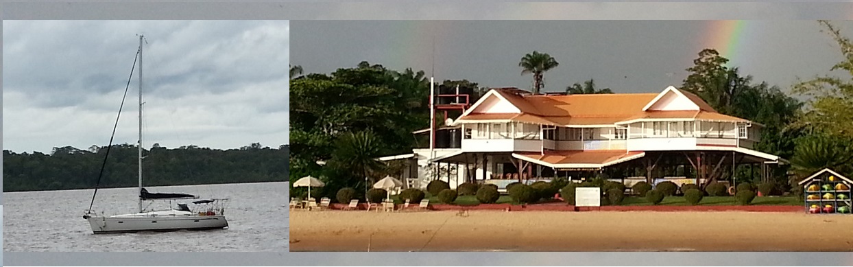
Note that the strong river current never goes away except for maybe a half hour when the tide changes the whole river all the way up to Baganara and beyond. In the open areas near the mouth, the west side of the river and off Bartica during the windy months a very nasty chop develops when the wind is at odds with the tide Some coves and quiet out the way spots to anchor are along the river so use them. Off Baganara is calmer always. But that chop beats up your dingy and makes for adventurous dingy entries and exits in the open areas with a long easterly or northerly fetch. It could be downright deadly at times if you go overboard at full ebb or flood and you are not picked up. A life vest would not be a bad idea especially for any not strong swimmers so have a comfortable one. You CAN swim against the tide except at full flood/ebb with a good set of fins if you are a strong snorkeler but it's WORK. You get about an hour of almost no current at slack tide to swim. I have spent a whole day in the water unmolested by any live creatures in open areas of the river and off Baganara. But watch that current. In addition there are large Caiman(Crocodiles) in the river.. mostly in very remote areas I have been told. I have also done Day Sails in the River in the area in front of Baganara and up and down the river to Bernards to the south and a line from the End of Baganara island to the rocky hill across the river that has a little deep protected bay on the Southwest side.
.